Caribbean Natural Resources Institute
Thursday, October 13, 2022
Following week-long ‘bootcamps’ in Anguilla, Montserrat and the Virgin Islands during the month of September, natural resource management stakeholders in these territories are now better equipped to utilise unmanned aerial vehicles (UAV drones) to map and monitor sargassum impacts.
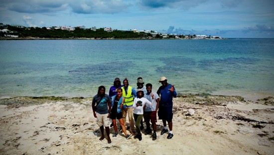
Anguilla Workshop Team (Credit: Kimberly Baldwin)
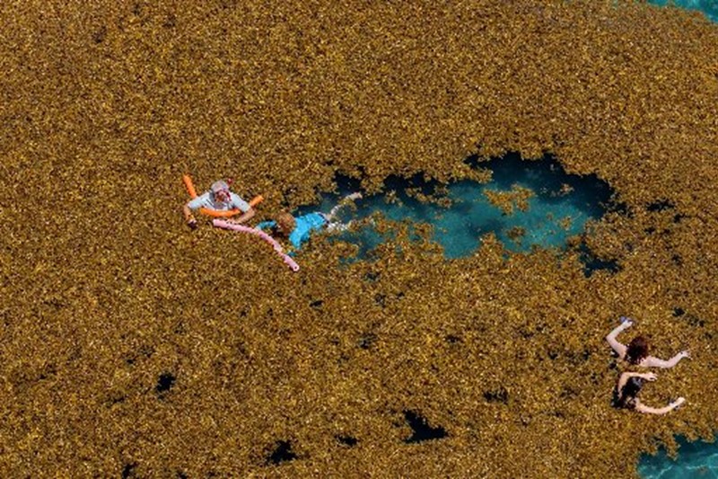
Sargassum influxes have had increasingly negative ecological and socio-economic impacts on Anguilla, Montserrat and the Virgin Islands since 2011. To address this threat, the Caribbean Natural Resources Institute (CANARI), in partnership with the Department of Natural Resources in Anguilla, the Department of Environment in Montserrat and the Ministry of Natural Resources, Labour and Information in the Virgin Islands, is implementing a 3-year project entitled, “Sustainable sargassum management in Anguilla, British Virgin Islands and Montserrat” funded by the UK Government through Darwin Plus.
The project takes a participatory and multi-level approach to the management of sargassum influxes to protect and enhance coastal and marine biodiversity and associated livelihoods. Key activities include: improving research, monitoring and early warnings of influxes to inform decision-making; strengthening multi-stakeholder engagement; and building the capacity of coastal and marine managers and users for sargassum use, removal and rehabilitation of affected areas. As part of the project, partner agencies, other resource managers and users are being trained in the use of unmanned aerial vehicles (UAV drones) to map and monitor sargassum impacts.
The ‘bootcamps’, which took place in Anguilla from September 5-9, Montserrat from September 19- 23, and Tortola, Virgin Islands, from September 26-30, 2022 were facilitated by Dr. Kim Baldwin, Director of Marine Spatial Information Solutions Inc. and the University of the West Indies - Center for Resource Management and Environmental Studies (UWI CERMES). During these five-day workshops, participants, including representatives from both the public sector and civil society, covered a variety of topics and took part in practical skills-based coursework as well as field and computer-based exercises.
Feedback from the participants has been overwhelmingly positive. Carencia Rouse, Director of Environment, Department of Natural Resourcesin Anguilla commended the training workshop, noting that she was able to develop a highly valuable skillset that has a wide range of environmental management monitoring applications in the Caribbean context, beyond sargassum, such as monitoring coastal erosion and mapping of shallow coastal ecosystems.
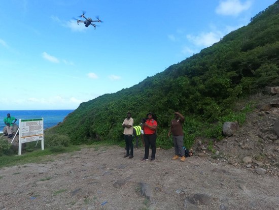
Workshop participants in Montserrat flying a drone (Credit: Kimberly Baldwin)
In Montserrat, participants were able to create a base map for Little Bay using the Drone Deploy software – something that will come in handy for tracking impacts of the port development project. Ajhermae White, Environment Officer in the Department of Environment explained that sargassum monitoring on the island will focus mainly on Margarita Bay and Bottomless Ghaut beach, which are the most heavily impacted by sargassum, whilst beaches on the western coast will be used to compare influxes. Laverne Rogers Ryan of the Physical Planning Unit described the workshop as “action packed and intense”, but as having equipped participants to fly the drones safely and to use them for a variety of environmental management applications.
Senior decision-makers in the Overseas Territories have also welcomed the training opportunity provided by the project. Speaking during the opening session of the Virgin Islands workshop, Acting Deputy Permanent Secretary in the Ministry of Natural Resources, Labour and Immigration, Mr. Mervin Hastings, emphasised the challenges that have been posed by sargassum to the territory over the years. “We have to do our best to mitigate how it affects our coastlines and find the best uses for
it so that best practices and sustainable by-products can be garnered from this seaweed that we encounter yearly”, Hastings said.
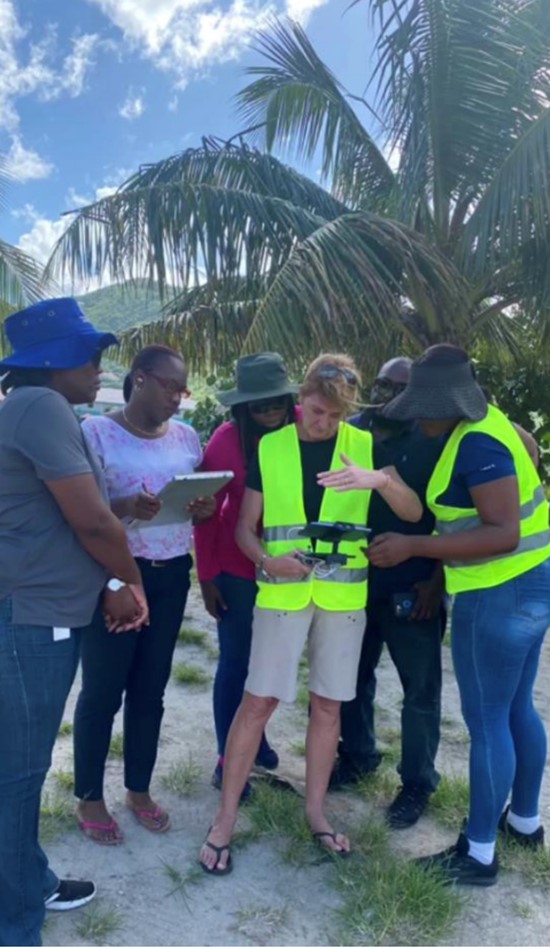
Participants in the Virgin Islands during a practice session (Credit: Kimberly Baldwin)
By utilising drone technology to monitor sargassum influxes, natural resource managers can more accurately estimate the volume of sargassum washing ashore and keep track of where and when this occurs over time. This information is essential for planning national responses and ensuring that the right equipment and resources are mobilised, but also for establishing viable business models for utilising this ‘golden tide’ as a resource for sustainable development.
Over the next six months, trainees will continue to receive technical support and will be actively guided in the development of national sargassum monitoring sites. Teams will learn to plan and conduct drone mapping surveys as well as collaboratively develop participatory monitoring strategies that will be implemented over the duration of the training package.


